Pages

Tuesday, August 30, 2016

7/8: Whitney

Sun pouring gold onto Mount Muir.
“From the sun I learned this: when it goes down, the exuberant one, it pours gold into the sea from its inexhaustible wealth—such that even the poorest fisherman rows with golden oars. For I saw this once and did not tire of my tears as I gazed on.” Thus Spoke Zarathustra, Friedrich Nietzsche.

The summit of Whitey is 7.5 miles from Crabtree Meadows with a 4000 foot elevation gain. I began my ascent around 9:00 AM on the 8th of July. My goal was to make it for at least part of the sunset. I was in no hurry. I decided that I was not going to blow through the Sierras. Instead, I was going to take my time and really appreciate every alpine lake, every mountain pass vista, and every valley. The Whitney trail slowly climbs 2000 ft. for roughly the first five miles, passing many lovely alpine lakes. About three miles in I stopped to rest at Guitar Lake (not so named because of its location). The great thing about being in the Sierras was the abundance of *ice* cold water in alpine streams and lakes. I started to make a habit of stopping frequently to soak my legs and so reduce swelling. The views were spectacular to say the least. The lake was flanked by the snow filled hills at the foot of Mount Hitchcock. The beautiful blue color of the lake water gave way to an inspiring vista of westerly snowcapped peaks of the High Sierra. I made my way to the base of Mt. Muir, which is to the south of Whitney, where the trail climbs about a mile along a ridge to the Whitney Portal trail. The switchbacks were not too steep but extremely long. Aside from technical mountaineering routes, there are two main trails that one can hike to get to the Whitney Summit: a trail that ascends from the west, which I was on, and only accessible via the backcountry; and a trail from the east, which is used by those traveling via car from Lone Pine. The two meet at the Whitney Portal trail junction near the top of Mount Muir. From there it is a rugged two mile climb up and down a spiny ridge connecting Mount Muir to Whitney.

Timberline Lake just outside of Crabtree.

Western High Sierra from Guitar Lake.

Mount Hitchcock and Hitchcock lakes on the left. Guitar Lake on the right.

At a little over 14.5K feet, Whitney is the highest point in the contiguous United States. Whitney also has a high prominence of over 10K feet. Yet two things struck me about Whitney: the variety of its facets and its modesty. Like a well written complex character in a novel or play, there are many interesting faces of Whitney. The eastern face of Whitney is a sheer crag. To the north and south is a complicated spiny ridgeline stubbornly joining the highest peak in the lower 48 with its peer peaks. However, the top of Whitney, along with the western face, is relatively level and rounded. That is until right before Whitney joins the western valley floor below, which it shares with Mount Hitchcock and Mount Young (to the southwest and north west respectively), where Whitney once again drops into a series of sheer spiny granite spires. Yet despite its complex character, Whitney is modest insofar as it never really stands out. It is flanked by Keeler Needle and Mount Muir to the south and Mount Russel to the north. When I hitched back to Horseshoe Meadow, a few days prior, we took Whitney Portal road for part of the way. From that particular easterly vantage near the floor of Owens Valley, the peaks surrounding Whitney seem to steal the spotlight, downplaying the prominence of Whitney’s peak. From the west, the rounded top almost makes Whitney look like it is shyly slumping, revealing its humility. 

The Whitney summit is on the right obscured by Keeler Needle (the little sharp notch jutting out on the right). You can see the snow fields on Whitney's gentle back.
A closer view.
At the same time, it was impossible to underappreciate the power and awesomeness of Whitney. Once I started hitting an elevation around 13K ft. the hike became more and more (and more) cardiovascular. After about an hour of laborious hiking along the trail crest I rounded a corner thinking that the summit was near. I did in fact get my first view of Whitney’s peak, but I felt crushed when I realized that I was still about 7/10 of a mile away.  After close to another hour of hiking, I finally made it to the summit! The summit was a very large boulder field, that reminded me of my summit of Mount San Jacinto, and on the summit sat a shelter built in 1909. I explored the edges of the peak admiring the spectacular views of the High Sierra to the west and north and the views of the Inyo Mountains towering over Owens Valley to the east. At one point I was the only person on the summit making me the tallest person standing on the contiguous United States! 

A snow chute on the way up to Whitney's boulder field. It looked a bit scarier than it actually was.

My first 14er!

North of Whitney. I think that is Mt. Russell on the right.

East from the summit. That's Owens Valley followed by the Inyo Mountains.
To my great surprise, people started coming over the sheer, southeastern sides of Whitney. It was two separate groups of mountaineers who had just successfully completed a challenging and dangerous mountaineering route to the summit. After chatting a bit, I decided to start my descent. I was overcome by the views as I worked my way back down the trail crest. Mount Muir and Mount Hitchcock were golden in the light of the setting sun. Recall that PCT hikers were not allowed to camp between Crabtree Meadows and the Whitney summit. This meant that I was supposed to hike the full 7.5 miles back to Crabtree. However, it was around 8:30 PM, which meant a long night ahead. Right below the Whitney Portal Trail junction, on the western ridge running down Mount Muir, there was an extremely small campsite on the corner of one of the switchbacks at around 13.5K ft. I decided that I would at least stop and eat dinner and admire the beauty of the valley as the sun finished setting and the moon chased close behind. But I was exhausted and my shin felt very tender. Not being a rule breaker but a rule maker, I decided to make a new rule: anyone hiking the PCT and the entirety of the John Muir Trail can camp on the ridge of Mount Muir. Recall the John Muir Trail starts at the Whitney Summit and continues over 200 miles to Yosemite Valley all the while mostly continuous with the PCT. I was going to try and at least finish the JMT so that I at least had a consolation prize should I not make it all the way to Canada, which was looking likely. So I reasoned that since I was not just a PCT hiker but now also a JMT hiker, the new rule allowed me camp before Crabtree.

Mount Hitchcock. Sunset from the ridge of Mount Muir.

The moon chasing the Sun from my campsite.

Starry night. That is a granite wall at my campsite. It is illuminated by the light of the Moon.

On the way down the next morning.
John Muir aptly said the Sierras should be called the Range of Light, so I felt it was very appropriate to finish the day admiring the play of light in the peaks and valleys from Mount Muir. I set up my tent, which barely fit on the small flat surface. I had difficulties sleeping that night. The issue wasn’t the weather since it wasn’t too windy, and while the air was very cold I felt warm in my tent and sleeping bag. I think the issue was sleeping at such a high elevation. No matter, I didn’t mind so much and got out of my tent between dreams in order to admire the plentitude of stars. Around 2:00 AM I could see a steady line of headlamps coming up the trail as people started making their way for a sunrise summit. (I was tempted to hike the 2.5 miles back to the summit myself, but it’s a strenuous hike and didn’t want to injure myself. No point in being greedy!)  As I lay in my tent I could hear the rhythm of laboring breath and trekking poles as people rounded the corner of the switchback. Often someone commented in surprise when a headlamp illuminated the fact that a person was camping so high. One person asked their companion in a tone of surprise, “Who would camp up here!?” The companion responded, “I don’t know. Maybe a ranger?” I’ll tell you who would camp in such a spot: A muthalovin’ PCT hiker—that’s who.


If you look closely on the right you can see the Whitney shelter and two people.


That's the Whitney Shelter in the background.
More stars from camp. I'm not set up for astrophotagraphy, so it's a little blurry.

Whitney's shadow in the middle. That's Owens Valley in the distance.


Sunday, August 28, 2016

7/1 to 7/7: Kennedy Meadows to Crabtree Meadows


Finally made it to the Sierras!


From Thirsty Games to Hunger Games

I left Kennedy Meadows on July 1st around 11:00 AM. The next big trail point was Mount Whitney, which I was super excited to summit. I was also extremely nervous that my shin would become inflamed again and I would have to bail before I got to Crabtree Meadows, which is the “base camp” for Whitney. My plan was to walk very slow and take short steps—a shorter gait can help with itbs and shin splints. I was determined to keep my mileage between 10 and 14 miles a day and stay on top of my stretches. While I did experience some discomfort in my shin, it never got worse and started to feel much better as I made my way north.


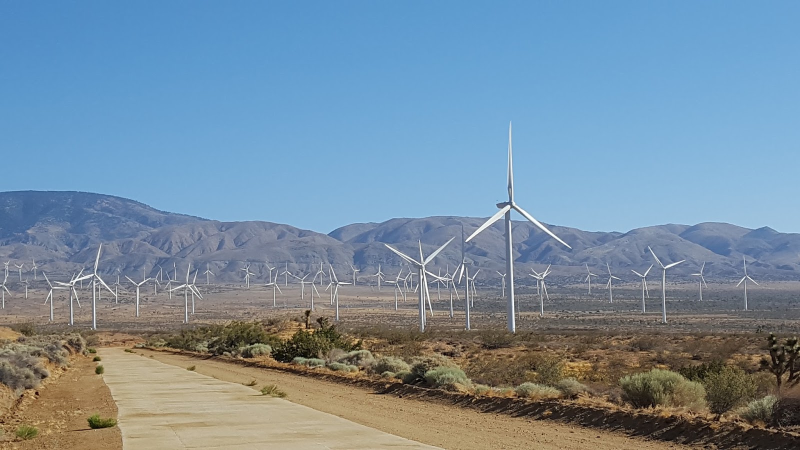
As I moved forward, the terrain started changing in big ways. The desert chaparral was quickly disappearing and the number and variety of pines was increasing. Pointed and jagged granite features became more and more apparent along the ridges. Overall, as the trail meanders north through the Sierras it goes through a series of mountain passes and valleys. As I came over my first big pass, Olancha Pass, big grass filled valleys came into view and I could see my first snow-capped peaks in the distance. I started to feel a tentative optimism that would erupt as joy when some of the views gave me butterflies.

Transitioning into the Sierras from the high desert. 

That's snow back yonder!
Or maybe the butterflies were the persistent hunger pains I started feeling. The climbs were getting bigger and my average elevation was now double what it was in the desert. Along with the bigger climbs and elevation, my appetite was growing monstrously. This was potentially problematic since I was eating more than I had planned for. Food resupply is a big challenge in the Sierras, since towns are not easily accessible. In the desert, towns are easily accessible and there are many road crossings, so you rarely have to carry more than five days’ worth of food. But once you get into the Sierras, the PCT does not cross any roads between Kennedy Meadows (south) and Tuolumne Meadows, which is over 200 miles. While there are opportunities to resupply, this often requires taking substantial detours off the PCT to get to a road from where you have to hitch to one of the towns located on 395. Complicating things further is the bear canister requirement from the Sequoia National Park boundary to Sonora Pass, which is almost 300 miles. Proper food storage is crucial for the safety of hikers and the bear population. Black bears are, for the most part, terrified of people. But if the bears start to associate people with food, they will come around more often and the chances for bad encounters increase. The two main effective ways of storing food are either hanging food in bag designed to keep bears (and other critters out) such as an Ursack or storing the food in a bear canister. Parks in the Sierras go for requiring the latter. I imagine there are two reasons for this. First, not everyone knows how to properly hang food. Second, maybe bear canisters reduce hiker impact on the wilderness since bear hangs usually require going off trail to find a tree and then throwing and tying rope around branches on that tree. As I would later discover, there are tons of people hiking in the Sierras, so that would be a lot of tromping and roping off trail. Of course, you never put your bear canister in your tent and should store it at least a 100 feet from your campsite.  You still have to go off trail, so I'm not sure if that is an advantage over allowing hangs. Regardless, the problem is that you need a lot of calories in the Sierras but are constrained by the capacity of the bear canisters.

The large version of the bear canister holds approximately 900 cubic inches of stuff. Since you need to carry a lot of food, a prerequisite to successfully packing a bear canister is being really good at Tetris, and fortunately I played a lot growing up. My plan was to carry enough food to get from Kennedy Meadows (mile 702) to Vermillion Valley Resort (mile 878), which is about 176 miles. If I averaged 13 miles a day that was about 14 days’ worth of food that I would need to carry. However, the trail is much more strenuous in the Sierras, and the difficulty is compounded by the higher altitude. All of this means burning more calories. Aside from filling the bear canister with Crisco and living off of that for two weeks, there was no way I was going to get 14 days of food in the bear canister. So I decided to pack about 4 days’ worth of food in my Ursack and do a bear hang until I got to the Sequoia border. The problem was that 3 days after leaving Kennedy Meadows I was eating a lot more than I anticipated, and after taking inventory and adjusting my rations, I realized that I was about three days’ worth of food short of making it to VVR. I didn’t want to force myself into increasing my mileage since my shin was still iffy. So at some point I was going to have to get off trail for a resupply. My first option was a side trail to Horseshoe Meadows from where I would have to hitch 22 miles to the town of Lone Pine. The trail to Horseshoe Meadows was about 15 miles north from where I was, so I would be able to get there by the next day, July 4th. I decided that this was the best option that required the smallest detour. The drawbacks were carrying more weight and the potential difficulty of hitching on the 4th.

Who knew you can find abstract expressionist art in the Sierras!
It turned out that the hitch to Lone Pine from Horseshoe Meadows was the easiest hitch thus far on the hike. As soon as I came off the spur trail and hit the road a small RV stopped to pick me up. It was a young person from Germany, named Mike, who had rented an RV to explore the west coast for a few weeks. Mike had just dropped off two hikers returning from Lone Pine and was heading back down. What luck! It is about 22 miles from Horseshoe Meadow to Lone Pine with about a 6000 ft. decent. All of this is on a road that winds down a very, very exposed ridge overlooking Owens Valley. Traveling in a car after hiking can be a bit nerve wracking, and this was hair raising to say the least. But, as usual, I kept telling myself that the driver has made it along this far in life and probably knows what they are doing. When we got down to the valley, Mike and I got a bit lost and turned down the wrong road, but it ended up being the best kind of getting lost. The road we stumbled on winded through a rock formation called the Alabama Hills, which is an odd name given that we were in California. Unlike the jagged Sierra ridges and peaks, the rock formations in the Alabama Hills are a recursive series of smooth, rounded oblong rocks. Given the unique rugged nature of the terrain, many Western movies have been filmed in this area.

Alabama Hills near Lone Pine, California
Once we found our way to Lone Pine, Mike dropped me off at the Mount Whitney Restaurant, which was fortuitously open. It was about 3:30 PM. I promptly went inside and ordered a beer, burger, onion rings, and two scoops of chocolate ice cream. It was late afternoon on the 4th, and there was no way that I was going to get back to the trail, so I got a room at the Dow Villa. It was about 5:30 PM. Since it was getting late and the 4th of July, I decided I would try to find an open convenience store and grab a snack. The first thing I saw when I got outside was a BBQ joint across the street. So I promptly walked across the street and ordered a rack of ribs. Apparently my hiker hunger was back in full force—I even snacked some more later that night. The next day I resupplied and had a relatively easy hitch back to Horseshoe Meadows and was able to get back to the PCT and hike a few miles. The day after 
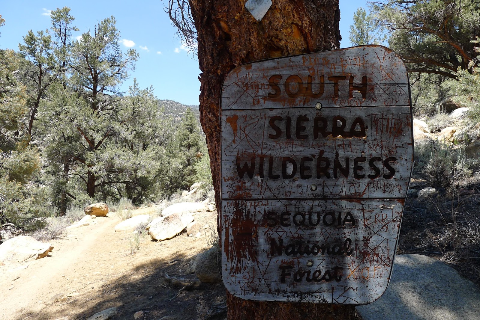
that I officially made it into Sequoia National Park. I was hoping to make it to Crabtree Meadows by the next day, and from where I hoped to hike to the top of Mount Whitney, the highest point in the contiguous United States and would be my first time hiking over 14,000 feet. The anticipation was building.


Social Expectations

House of Marmot. Crabtree Meadows.
Aside from the terrain, I notice other changes from the desert. For one, my health—my legs were feeling stronger and had improved a lot since the desert. Second, unlike the desert, there was water everywhere, so despite having to carry more food, I had to carry much less water between sources. However, the biggest change from the desert was the people. People were suddenly everywhere. Don’t get me wrong, there are plenty of people in the desert, but most everyone is heading north and there were many days when I did not see a single person or only a few. Moreover, in the desert, almost every person I encountered was another PCT hiker. But now I was running into a lot of day hikers and weekend warriors. Most striking was the contrast in the social expectations of PCT hikers and many non-PCT hikers. Let me explain. PCT hikers are open and friendly in a way that might be considered too much or odd for the frontcountry (i.e. out of the wilderness, off the trail). Almost every PCT hiker says “Hi! How are you?” and will enthusiastically listen to your answer. And often when PCTers find themselves taking a break, camping, getting water, eating, etc. in the same place, they usually have a conversation about a variety of things: their life in the “real world”, trail stories, crazy people on or off the trail, etc. Also, for the most part, it is acceptable to ask a complete stranger on the trail where they are coming from that day, where they plan on camping, etc. In contrast, when we’re in the frontcountry, most of us keep to ourselves as we go about our days in our communities. There are socially acceptable places for strangers to interact, e.g. coffeeshops, bars, other gatherings, but even in these contexts people often are still relatively reserved. And it is definitely unacceptable to ask a complete stranger where they are coming from that day and where they plan on sleeping! But spending a long time in the backcountry or going on a thru hike is a catalyst for bonding. There is something nice about this. On the first day of my hike I met and learned a lot about five people I had never met before in my life. Moreover, we had conversations about morality, religion, love, relationships, and other more personal topics. This rarely happens in everyday life. While many day hikers and weekend warriors were very nice and kind and even open, I noticed that many of them were very reserved and not as open as PCT hikers. I got the feeling that many of them were still operating with frontcountry expectations for social encounters, and I think this made many interactions with them awkward.


A Question About For Profit Guided Hikes

I felt this contrast most strongly when I ran into a tour group hiking through the Sierras. This was a guided hike that followed most of the JMT and was run by a private company. I was told that because the hike was organized by a private company, they could not hike into Yosemite Valley. I suppose that Yosemite will not issue permits for hikes organized by private companies. However, the group apparently had permits to operate in Sequoia and Kings Canyon National Parks. Right away I had mixed feelings about this company and other for-profit guided hikes in the Sierras. In general, I’m not sure how I feel about for-profit organizations operating in public national parks, especially in the backcountry. Clearly there are some exceptions. For example, in Yosemite Valley (which really isn’t the backcountry anyway) there is a demand for food and beverage, and I do *not* think that there should be federally run restaurants meeting that demand. These services can be provided by a private, for profit company, but it should be in a designated area of the park. And of course there are some educational programs that teach people skills they need for the backcountry, such as Ned Tibbits’ Mountain Education Inc., but this is a non-profit organization. This is a complicated issue, but even setting it aside, I had other concerns about this group and similar tour groups. A part of effective environmental stewardship is keeping groups of backpackers small, which minimizes impact on the wilderness. But this was a group of over 9 people, including the two guides. Moreover, a clear Leave No Trace Principle is to be considerate of other visitors. There are many things that go into being considerate, and some examples might include giving faster hikers or ascending hikers the right-of-way, not clogging up the trail, leaving enough room at campsites for other backpackers, etc. By virtue of the fact that this group was so large and was composed of people with experience that ranged from none to some, they clogged up the trail on the passes and crowded campsites (some of this I saw for myself, some if this I heard from other hikers). For example, one day after putting in a grueling 14 miles I was exhausted, sore, and ready to camp. But I had to hike an extra mile at the end of that long day because this group had taken up more than 80% of a designated campsite (the rest was taken up by unrelated backpackers). More upsetting was when I saw more than one member of the group washing their clothes in a creek. At the very least the guides have a responsibility to inform the group of leave no trace principles and to correct violations.

But I also found that the tour group made backcountry socializing needlessly awkward. For example, it often seemed that the interactions between people (full grown adults!) in the group and other people on the trail, including myself, were being chaperoned by the guides. And on one occasion two of the hikers introduced themselves to me and asked questions about hiking the PCT. We were having a great conversation when one of the tour guides furtively informed the two hikers that dinner was being served. Not only was it awkward that notification of dinner had to be so secretive, but dinner on the trail is often a chance to meet and bond with new people. These folks were on the trail and certainly experiencing beautiful things, but it seems like their overall experience was being constrained by the fact that the hike was guided. So, if you have considered doing one of these guided tours and you want my unsolicited opinion, I think these tours are probably not worth the money (this assuming that the trails are passable and safe; if you are trying to acquire new skills such as snow travel, then by all means take a course) and possibly not environmentally responsible. I mean, it’s true, many people who go on these guided tours don’t have to cook or get their own water or deal with many logistical challenges, but that’s all part of the fun and is what takes you from a generic facebook vacation to a substantial life experience. If you are healthy and have half a brain, just do the work and planning yourself. This way you are not tied to a group of strangers and the itinerary of potentially control-freak guides. You will be in charge of your hiking adventure, which will make it much, much more special. And it doesn’t matter if you are not from the US—I met unsupported PCT and JMT hikers from Mexico, Argentina, Brazil, Canada, France, Switzerland, the UK, Korea, China, Australia, and I’m quite sure that there were plenty more nationalities on the trail. Don’t be afraid to step out of your comfort zone—that is part of the wilderness experience and something you can accomplish before you even get to the trailhead.

Wild?


So what is wild about the PCT anyway? This is something I had been struggling with a lot. And, to be perfectly honest, to that point on the trail I’m not sure how often I managed to fully appreciate the wildness that is supposed to come with the 
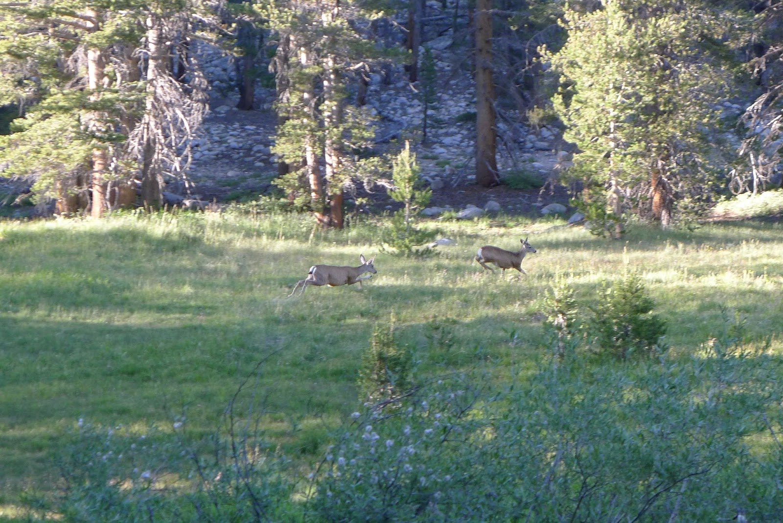
wilderness. For example, the night before I hiked to Horseshoe Meadows I camped around mile 734. At this point I was definitely in the Sierras. I was above 10K feet, there were pines and firs everywhere, giant granite rock piles and peaks, and the best part was that I could walk over to the edge of the ridge and look down 6000 feet into Owens Valley. As I was doing my evening stretches, a deer came right into my campsite. It stood there staring at me and I at it for a good five minutes. It was very beautiful, but then it struck me: I was missing something—something about it still felt contrived, like I was watching a stage prop or in a theme park. I was not appreciating the wildness of the encounter. What is it to be ‘wild’? I imagine that part of the story is as follows: some (terrestrial) area or thing is wild insofar as it is free from the intentional or unintentional causal influence of human activities, where the influence is obvious or direct. The last qualification is important because one could argue that my encounter with the deer was the effect of human activity—humans declared that the Sierras would be a national park and preserved as such, which allowed the deer to live and one day come into my camp. But that isn’t quite right because my encounter with the deer was different in an important way from encounters with domesticated animals or an encounter I might have with a dolphin at SeaWorld. The difference is that the story about how I might come to encounter a dolphin at SeaWorld would obviously involve the intentional activity of humans—namely, humans putting the dolphin in captivity, keeping it in a facility that was constructed by humans, feeding it, training it, etc. But the story about how I came to encounter the deer in my camp doesn’t obviously involve the intentional activity of any human—namely, no person captured the deer and put in the Sierras—for all I know I was the first person that deer ever encountered, nobody feeds that deer, likely nobody cares for the deer if it gets sick, etc.  Yet there was still something about my encounter that felt artificial to me. I couldn’t quite pin it down. Overall, while I’ve been on the trail, it has been difficult to shake the feeling of civilization or society. All I can think is that very often the Pacific Crest Trail has felt like some city sidewalk that took a wrong turn somewhere. Part of what has engendered this feeling has been all of the towns I have gone through, all of the roads I crossed, and all of the stress of hiking. Unfortunately, even in the backcountry I have felt the stress and pressure of sticking to a schedule, running errands, doing chores, etc. Often everyone is running like mad to make miles for the day, get to the next water source, or make it town before Sunday so they can go to the post office. This feeling was exacerbated as I got closer to Mount Whitney and the trail became more crowded. At least in the desert there were times when I could feel the wildness through the feelings of vulnerability that came with being alone and isolated, especially when camping alone. I hope that I can have this experience in the Sierras at some point.

From mile 736. Owens Valley in the background.


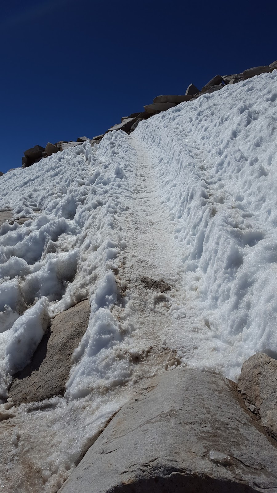
I made it to Crabtree Meadows on the 7th around 1:00 PM. The plan was to rest for the day before the Whitney Summit, 7.5 miles off a side trail. A sunrise summit would be awesome, and is what most people went for. But PCT hikers were not allowed to camp anywhere between the Crabtree Ranger Station and the summit (including the summit). The sunrise at the summit occurred before 5:00 AM. I still wasn’t feeling confident about my shin, so if I was going to make a sunrise summit, I would have to leave at midnight. That didn’t seem worth it to me, so I decided to try and go for a sunset summit.

More deadwood art.

Saturday, August 27, 2016

6/14 to 7/1: Antelope Valley


LA Aqueduct

Everything Falls Apart

According to Buddhist philosophers, all conditioned things—any thing whose existence is dependent on something else—are transient or impermanent. Moreover, according to Buddhist philosophers, since all existence is conditioned, everything is impermanent. Whether or not this thesis is true in general, it is painfully true on the PCT at least. All of your plans, your gear, your body, your mood, your food, your water are dependent on something else and so will change or fall apart at some point. By the time I arrived in Mojave, I experienced multiple complications with my gear. The ignition on my Jetboil broke, which wasn’t too bad since I could still use my lighter to ignite my fuel. The zipper on my tent started acting up, but if I was careful I could still get it to close and keep the buggies out. A seam in my pack started to split leaving a gaping hole in the back. But the problem was more cosmetic than functional and ULA had a free replacement waiting for me in Mojave. More problematic was the hole in my air sleeping pad that I got the night before I made it to Mojave. But worse than all of this was the physical and emotional collapse I experienced after I left the Andersons.

I’ve already mentioned the issues I had with my IT band, but in case I have underplayed the extent of the pain I felt, let me explain. The iliotibial band is a thick ligament that runs from the hip to the shin along the outside of your thigh. When this band tightens from extensive use it repeatedly rubs against bone and becomes inflamed. I had experienced IT band inflammation in my right leg before the hike, so I was familiar with it. However, it was not my right IT band that became a problem during the hike but my left. Consider a scale of 0-10, where at 0 there is absolutely no pain, 1-2 is noticeable sensations in the affected area, 3-5 is noticeable discomfort with possible change in behavior, motion, gait, etc., 6-8 is grimacing discomfort and definite change in behavior, motion, gait, etc. and 9-10 is extreme discomfort with an inability to perform some activity and considerations of death or at the very least amputation as a means of relief (and 11 is the complete dissipation and transfer of all bodily matter into the dimensions of hell). Starting on the fifth day of my hike the pain in my left (and sometimes right) IT band consistently stayed between 4-5 and would sometimes reach levels between 8-10.5. The pain was mostly located on the side of my left knee. I would walk a few miles and then I would start experiencing extreme pain at the slightest bend of my knee. Of course walking requires bending you knees—a lot—so this was not a good situation to be in.  Sometimes I could walk through the pain. Sometimes I would simply try not to bend my left leg at all while hiking. Of course, this kind of compensation did not get rid of the pain and could have led to further injuries, so sometimes I would just have to stop hiking for an hour or so. I stretched, took lots of Aleve—sometimes potentially kidney damaging amounts, and took about 7 days off in total to ice and rest during the first month of my hike. There were many times I wanted to quit hiking because of the pain and even thought that maybe it was the healthy thing to do. But after Wrightwood things started improving greatly. As I said in the previous post, by the time I left the Andersons I was feeling really good and planned on hiking 30 miles the day after I left. But nothing is predictable on a hike, and if it’s not one thing, it’s bound to be another. On the day I came down the Angeles Crest and started approaching Hikertown—a sort of hostel on Highway 138 that is not to be confused with Hiker Heaven—I started experiencing extreme pain in my right shin. On the previous night, the pain was subtle, perhaps a 2, but on the next day after about eight miles of hiking the pain advanced to level 9. Though I had never had them before, I knew right away that I had some form of shin splints, which was bad. Unlike ITBS, you cannot walk through shin splints, and if you try, then the inflamed tendons will tear small pieces of bone from your shin if that has not already happened. This new injury was potentially trip ending in a very big way. If it wasn’t the physical pain, it was the emotional pain and frustration that brought me to tears. Right before Highway 138 the trail has to meander around private property. Every step was extremely painful and seemed to not get me closer to Hikertown so I could rest and assess my situation. The pain was so bad I had to stop every 50 feet. In one of my lowest points on the trip, in complete frustration and dismay I went Kylo Ren with my trekking poles on a dry dead tree (very bad LNT). I eventually hobbled my way down to Hikertown, where I would spend a very strange and depressing two nights.

Smoke from Santa Barbara wildfire as I was coming down the Angeles Crest. Approx. mile 510.

True Lies

Hikertown is located on Highway 138 in the Antelope Valley of the Mojave Desert. Antelope Valley is flat, dry, hot, very windy, and largely undeveloped. The LA Aqueduct runs through the valley carrying water from Owens Valley in the Sierras south to LA. Hikertown is not a town but a 2-3 acre piece of property owned by a somewhat eccentric developer and former movie producer who owns much of the land in this area. On the property sits a main house surrounded by a number of small shanties and tiny trailers. Many of these structures have faux facades of the kinds of buildings you would expect to find in a Spaghetti Western—a City Hall, City Jail, Feed Store, Motel, etc. There were random cars, tractors, plywood cable spools, bathtubs, and piles of random objects in between the various shelters. When I arrived, Steve and Danielle were leaving and there were three other hikers there. Rounding out the overall affect of abandonment was a thin layer of dust covering everything. Hikertown was sort of run like a hostel, and it was managed by a caretaker who seemed to be a bit neurotic and somewhat passive aggressive but otherwise nice. And I imagine it had to be somewhat stressful to manage such an unruly piece of property infested daily with a large number of hikers and visitors during the peak of the season. While there was a required “donation” of $10, it seemed to be ineffectively and inconsistently enforced.  The caretaker and I got along just fine though there were tensions with other hikers, and maybe it had to do with my making the “donation” but others not. Many hikers have packages sent here or at the very least stop for water. About four miles east on Highway 138 is a small convenience store with a burrito bar and a lounge area where hikers sometimes congregate.

Hikertown.

Old timey facades.
I didn’t want to stay here—it felt strange and I wanted to keep hiking! But I could not walk. The caretaker set me up in one of the tiny trailers. This trailer was about 12 ft. by 6 ft. with a single size bed that looked like it may or may not have had bed bugs (despite appearances, after two nights there I’m pretty sure that it did not in fact have bed bugs). The floor was made of fake wood. There were outlets in the walls, but no electricity. All of the walls had fake wood paneling and the easterly facing wall had a small window, which did not open, and a sliding glass door (which did open). It was cold at night and very hot during the day. The trailer was not air conditioned and would trap heat from the Sun creating a little toaster oven. By 10:00 AM it was easily over 90 degrees Fahrenheit inside the trailer. The wind howled, whistled and rocked the trailer pretty much 24 hours a day. But the wind did not help with the heat in the trailer because it was blowing from the west and the sliding glass door faced east. The ceiling had old ceiling tiles, like the kind you find in old businesses and school classrooms—you know, the kind full of tiny holes and asbestos. I had hoped that after the first night my shin would feel better and I could hike out at least making small miles, but instead it felt worse. I could hardly put any weight on my leg. I thought that this was how my hike was going to end: helpless in an oven shanty with fake wood walls that is part of a fake town in the middle of a big fucking empty desert. Moreover, there was no easy escape to civilization should it turn out to be the end of my hike. It felt like some sort of surreal allegory of the hike en total and possibly of my life. I didn’t start university until I was 27. During this time, on really bad days, especially in graduate school, I’ve worried that it has all been motivated by some sort of latent narcissism and therefore empty and therefore I have been living as a sort of intellectual imposter with no clear or obvious way out or alternative. This hike was now potentially a failure with once again unclear motivations and no obvious way out. This was a new existential low on the hike.


On day two I hitched to the convenience store. There was a broken down newer model BMW nearby. Two construction workers passed me but turned around and gave me a ride. They asked if the BMW was mine. Couldn’t be farther from the truth. I spent the day in the lounge of the convenience store icing my shin, consuming what is normally an unhealthy amount of fat and sugar but which my deprived body burned faster than you can say “more deep fried snickers wrapped in pizza, please!”. In addition to the empty calories, I consumed lots of empty entertainment. It turns out that the movie True Lies, starring Jamie Lee Curits and Arnold Schwarzenegger, really, really sucks. Not only is the dialogue incredibly lame, but the movie is also extremely sexist, bigoted, and xenophobic. The only saving grace of the day was the guitar I had found at Hikertown, which I spent a lot of time playing. I kept icing my leg and kept it wrapped to reduce the swelling. That evening two hikers showed up. Including myself, that made a total of 5. I went to bed hoping that my leg would feel better it the morning, but it didn’t. And in a very strange turn of events, when I woke up, I was the only hiker left at Hikertown. In fact, the caretaker and I were the only ones left on the property. The caretaker was walking around passive aggressively cleaning. He informed me that he threw everyone out the night before and was closing for the season. This was very odd. While the main bubble of hikers was a couple hundred miles ahead in the Sierras, I was pretty sure that I was not the last hiker on the trail and that there were still quite a few hikers behind me. Regardless, now I was in a bind: try to hitch 40 miles so that I could bail or try to hike with my injury.

I packed up my gear and got a hitch to the C-Store around noon. I decided that I would try to hike out that night. The next section of PCT ran directly along the LA aqueduct for about 30 miles and was extremely exposed. Temperatures were in the 100s, so hiking out during the day was not an option—it was time to try night hiking. If you want to minimize time in the heat, basically there are two options: second shift, where you hike mostly between 5:00 PM and around 2:00 AM; or third shift where you hike mostly between 9:00 PM and around 6:00 AM. To that point, I had been fairly resistant to hiking at night. But I started thinking about all of the times I would go to happy hour and find myself still drinking and dancing at 2:00 AM. So, if I could do that, why the hell couldn’t I hike second shift? No reason. So that’s what I was going to do. I still wasn’t sure how bad my shin splints were, namely I wasn’t sure if I had a stress fracture. So, my plan was to take it slow, take short steps, take lots of Aleve, and take a break every hour. No matter what, I was going to make it to Mojave and rest for a few days and then decide whether or not to bail. Around 5:00 PM I got a hitch from the C-Store back to the trail. It was a younger person who wanted to hike the PCT one day and so was super excited to give me a ride. His enthusiasm for just helping a hiker was a bit contagious and lifted my spirits.

Black Cows at Midnight

Sun setting behind the Tehachapi Mountains. 
It was still brutally hot. But after a couple hours the sun started setting behind the mountains to the northwest creating a lovely silhouette. The color field in the western sky was spectacular. The Joshua trees, which were gilded by the setting sun, looked like people congregating on the valley floor for nighttime festivities and cheering me on. To the southeast the moon was rising bright and full. This would be my nightlight. After being excited by the heat of the sun all day, the air sitting on the valley floor settled into a steady, calming evening tone. Despite the pain in my shin, I was moving slow and steady. After the brief evening respite, the night began to come alive. LA aqueduct flowed exposed for the first few miles after Highway 138 and then flowed into an underground pipe system that was covered by a concrete pathway the size of a small road. This concrete pathway served as a maintenance road and also served as the PCT for about six miles. It also served as a lovely backdrop for my moon shadow, which I watched dance along as I gradually headed northeast. At one point I came across what appeared to be a trailer park or junk yard of some sort sitting on the north side of the trail. The tops and sides of the structures were illuminated only by the moonlight. From what I could see, if what I was seeing were in fact trailers, they seemed dirty and in disrepair. Moreover, the area was only accessible by a dirt road and I had not seen any cars. So I figured that it was an unoccupied junk yard of some sort. By that point the pain was worsening and I was stopping every 45 minutes to rest. Despite the pain, there was something excited about hanging out in the moonlight in the middle of a desert valley floor. I stopped to rest about an 1/8 of a mile northeast of what I thought was an empty junk yard. Then I heard loud voices. My blood ran cold as I tried to locate exactly where the voices were coming from and where they were going. It turned out that the voices were coming from what I thought was the abandoned junk yard. Fortunately, they were staying in one location. I guess the lot was a trailer park after all. Still, my adrenalin was pumping and thoughts of being abducted and tortured by some fringe desert valley community motivated me to keep moving. I made it about 300 yards when I saw two pairs eyes glowing in the night staring at me. I froze and struggled to make out what had grabbed my attention . Eventually I was able to distinguish the silhouettes of two black cows from the other shadows and silhouettes. By 1:30 AM I felt exhausted and could no longer hike with the pain. I found a flat spot near some Joshua trees off of a service road. I was a little nervous about camping there because I wasn’t sure if I was on private property, but I figured I would get up early enough to get back on the trail before anyone came by.

Heading north along the LA Aqueduct.
Joshua Trees. Approx. mile 524

My nightlight.

Morning Joshua Trees.
I was back on the trail by 5:00 AM. I managed to hike about 4 hours before the heat became unbearable. The best I could do for shelter from the sun was some sort of large pine shrub. Eventually the sun chased me out and I had to move and find shelter. I was close to a farm of wind turbines and decided to make my way to one and take shelter in its shadow. It was over 100 degrees Fahrenheit and windy. Nothing was moving. There was a small flock of birds also taking refuge in the shadow of the looming wind turbine. Everything was hot: the wind, the air, the ground, my water, … I still felt depressed but I could not bring myself to officially call it quits. Besides, it would have been pointless since no matter what I had to hike into the Tehachapi mountains to get to Mojave. So I tried to find some optimism and bargained with myself while hoping that I wasn’t in denial. So, in the shadow of that looming wind turbine I decided that I was no longer going to make it to Canada and finish the entire trail. My thru hike was turning into a section hike. I managed to hike most of the desert, which I was grateful for, but I really wanted to hike through the Sierras, which was the original motivator. I figured that if I could average 9 miles a day I could at least make it to Yosemite Valley in time to fly out of Reno so that I could attend a philosophy workshop/conference, Metaphysical Mayhem, I was accepted to. Originally I had planned on flying back to the trail after the conference, but if I was going to have to fly back to Reno and not Portland, there was no way I was going to make it to Canada before the Washington snow. This prospect was disappointing, but nowhere near as disappointing as the prospect of quitting in Mojave and missing the Sierras.

Hotz!
Antelope Valley Wind Farm.

So loud!

Grasshopper sharing the shade.
By 5:00 PM I could no longer take the boredom, uncertainty, and frustration. The temperature had fallen from 111 degrees Fahrenheit to about 100, so I decided to move forward but slowly. My leg still hurt but could have been much worse. I made it to Tyler Horse canyon for some much needed water and surprisingly ran into four hikers that I had met at Hikertown. Two of them had been kicked out by the caretaker at 2:00 AM that last night I was there. I asked them what had happened. They were not sure. They said they offered money, but nothing would change the caretaker’s mind. He said that he was closing due to the heat wave. This might have made sense except for the facts that he did not kick me out and even if he was closing due to the heat, that didn’t require making people leave at 2 AM when it was a bit chilly. It was a mystery. Anyway, it was 6:30 PM, and the hikers I ran into were going to hike through the night and try and hike the remaining 16 miles to Tehachapi-Willow Springs Road from where you can hitch to the towns of Tehachapi or Mojave. Since my shin pain was slowing me way down (I was limping pretty bad), I knew I couldn’t make the entire 16 miles. However, I knew I could get to the road by noon the next day if I hiked late into the night. I had a new pack from ULA waiting for me at the Motel 6 in Mojave and I wanted to rest for a few days with the hope that my shin would improve. So I began my climb into the Tehachapi mountains.


Sheep as I started hiking towards Tyler Horse Canyon.
That night ended up being my worst night on the trail.  There was a 2000 ft elevation gain between miles 541 and 548 and due to past storms the trail, which was like beach sand, was completely washed out in many places. To make matters worse the light of the moon was hidden behind a ridge until late into the evening so the trail was difficult to find even with my headlamp. I lost the trail a few times and almost slid down a ridge. My shin starting hurting more and more. By 12:30 AM I was at the top of a ridge and completely drained physically and mentally. The wind was blowing steadily over 25 mph and gusting up to 40-50 mph. I couldn’t set up my tent so I inflated my air pad and tried to sleep. My air pad, which had a slow leak, was punctured by a rock, and I woke up at 3:00 AM. The wind was very intense and there was no way I was going back to sleep. I had 10 miles to go, so I decided to get up and make my way. I was so exhausted when I stopped earlier that night that I didn’t pay attention to where I had come off the trail. After about 20 minutes I found the trail. I wasn’t on the trail for more than 10 minutes when a strong gust of wind nearly knocked me back and blew sand in my eyes. It was really bad in my right eye, which felt like it had sand stuck in it and I could barely keep it open while I hiked. There was a water cache at the top of a ridge, so I took a small bottle of water and tried to flush my eye out, but it didn’t work. There were large ants all over the trail, and I got 5-6 really painful bites. One of them was particularly bad—it was swollen and extremely painful for over 24 hours and the skin around it was clammy and cold. A number of people had suggested that it was a scorpion bite and not an ant bite. By the time I made it down to Tehachapi Road I could barely put weight on my shin. Eventually I made it into the town of Mojave.

Cool rock sediment.
Mojave

I spent the next six nights at the Motel 6 in Mojave. There is not much going on in Mojave. You describe it as a tumbleweed town with lots of poverty. So the Motel 6 was very cheap and also gave a nice hiker discount. Despite expectations, the room was very clean. The first three days the wind storm that had started on my decent from the Tehachapi mountains was still in full effect. The winds were gusting to 60+. The power went out a number of times and there were 4-5 inch waves in the pool. I spent the next five days in my room taking lots of Aleve, icing my shin every hour, stretching, and trying to do some philosophy. Every day I would walk to get ice or to go to the store hoping that my walk would be pain free. There was some improvement, but not enough to feel confident about getting back on the trail. However, I couldn’t stay in Mojave forever, so I had to decide: bail while I had access to public transportation or get back on the trail. I decided that I would get back on the trail. My plan was to leave on a Saturday, but a fire broke out near Lake Isabella and the pcta closed the 90+ miles of trail from Tehachapi to Walker Pass, which is 50 miles south of Kennedy Meadows. I wasn’t sure what to do. I reached out for help on the facebook PCT page and trail angels, Erica and Jason, in Ridgecrest offered their home to me and could arrange a ride to Kennedy Meadows, which is where the Sierras start. This meant skipping 140 miles of trail. Despite the fact that I was entertaining the thought of not making it to Canada, I still wasn’t 100% sure and wanted to have as continuous a hike as I could. But with the fire closure and remaining shin pain, things were out my control. I decided to take up Erica and Jason’s offer and took a bus to Ridgecrest.


I spent a day at Erica and Jason’s and then got a ride to Kennedy Meadows from a former thru hiker named Scott. I was relieved to see lots of hikers still at Kennedy Meadows, which is a major resupply point for all PCT hikers. I ran into some old new trail friends. Every morning the teenage child of the owners of Grumpy Bear’s Restaurant would come pick up hikers and take us to the restaurant. They only had one breakfast: eggs, bacon, hash browns and a pancake that was about 16 inches in diameter and 2 inches thick. I tried my best two mornings in a row, but after a week off the trail I mostly lost my hiker hunger and I was unable to eat absolutely everything (but I came close!). While I was at Kennedy Meadows, a reporter from the LA Times called the general store and asked to speak to a hiker about the fire closures on the trail. The store owner asked if I could do the interview and I obliged. (The interview is here.) The story is not a general story about the fires, and the point of the article to look at the fires and closures from the perspective of a thru hiker. However, I want to emphasize that I fully understand that the inconveniences to hiking that come with trail closures are nothing compared to the benefit and necessity of the closures to repairing the ecosystems damaged from current and past fires. Most importantly, any obstacle that the closures present to hikers is nothing compared to the real and substantial loss people in the affected communities experience, and I have upmost respect and admiration for the California fire fighters who risk their lives to save homes and protect the wilderness.

I spent two days getting ready for the Sierras both mentally and physically. I had sent my ice axe and crampons to Kennedy Meadows when I flew into San Diego, but I arrived to KM late enough in the season to send them to my grandmother’s, which saved some weight. Every little bit of weight I could save helped. A bear canister is required through most of the Sierras, which weighs 2-3 lbs, and most hikers pick up their bear canister in Kennedy Meadows. I also had new shoes and inserts waiting for me as well as food that I mailed from Mojave. Most importantly, I was able to rest my shin for a few more days. To me the most tragic way the hike could end would be not making it through the Sierras. Fortunately, my shin improved a lot by the time I left Erica and Jason’s. It was still swelling a bit at night but would improve as the day went on. The day before I left Kennedy Meadows I hiked a couple of miles without a pack and experienced no pain. I started to feel more optimistic.

It is alleged that right before he passed, Gautama’s last words were, “All conditioned things are transient. Strive on with diligence.” So, despite the injuries and complications, I decided to hike on with diligence.

6/7 to 6/14: Wrightwood to Casa de Luna


Sunrise from Mt. Baden-Powell
Small Improvements

I left Wrightwood feeling a bit more optimistic about the hike. My IT band felt better after a couple days of rest and I picked up some new stretches that seemed to be helping. After a grueling four mile 2700 ft. climb up a ridge of Mount Baden-Powell, I decided to set up camp just 2/10 of a mile from the spur trail to the summit. The sun was setting and there was just enough brush to cut some of the light leaving a golden orb framed by the trees. A bird joined me at camp and provided a lovely song as I prepared to rest for the evening. I woke up at 3:30 AM and headed to the summit. It was very chilly and extremely windy with gusts up to 35 mph (or so I would estimate). At first I summited a faux peak but the sunrise was stunning nonetheless. Eventually I moved to the actual peak to finish watching the sunrise. On my way down from Baden Powell my leg starting acting up again.

Sun Orb. Climbing Baden-Powell Mile 379


Venus rising with the Sun. Mt. Baden-Powell

Almost worse than the physical pain is the emotional and mental frustration that comes with an injury. Is this the end of the hike? Should I quit, am I making things worse? As my leg locked up on the descent from Baden-Powell, I felt my spirit fall. I hobbled to a nice area and spent an hour gently stretching. It turned out that the stretches I added to my repertoire were extremely effective. Unlike previous days, on this day the pain did not return full force. And on that day and in the following days, when I could feel my knee tightening up, the addition of new stretches made managing the pain much easier and kept my knee more flexible. I was no longer spending miles a day hiking up and down ridges like a peg legged pirate. It was during these days that I discovered that music also helped immensely with the physical pain as well as the  mental angst that had often accompanied my days. One day I was nearly out of water and had six miles to the next water source. I wasn’t so much worried about being thirsty or becoming dehydrated, but when I realized that I *had* to walk six miles to the next source I suddenly felt extremely burned out. I was sick of walking. By that point I had only listened to music briefly at night and it was usually Romantic or Impressionist era classical music. I had hesitated listening to music while hiking for two reasons. First, I wanted to hear rattlesnakes if they were around. Second, I wanted to fully enjoy and be immersed in my surroundings. But I had only seen two rattlesnakes in the 400 miles I had hiked to that point. And as beautiful as bird songs are and as inspiring as the still quiet of the forest can be, I could only take so much before it started to become monotonous. So, I cranked up some NOFX, and started pushing forward. The difference that music made to my morale was immense. Moreover, listening to music after an audio fast greatly enhances the enjoyment of listening. For example, the deep bass sounds of electronic music don’t just sound good but feel really, really good. I didn’t listen to music all day or even every day; I still enjoyed the creaking pines, warbler songs, and white noise of the wind rushing through the brush. But a couple of hours on many days helped get me though some rough spots of physical pain and mental frustration.
   
Moisture colliding with the Angeles Crest approx mile 426
A bee rooting around in Poodle Dog bush. Poodle Dog bush is toxic and causes a skin reaction much worse than poison ivy. It is easy to identity by its smell: Do I smell hikers smoking weed around the corner? Nope! It's just Poodle Dog bush. It was really bad for about 40 miles requiring constant diligence and sometimes body contortions to get around.


Acton: Spiritual Confrontations

Things were improving physically and mentally and my daily mileage was increasing. I was starting to make progress. Eventually I caught up to a couple from Australia, Danielle and Steve, and we frog leaped for a few days. It was really nice to have some company at the watering holes and on breaks. Trail legend had it that rangers sometimes sold candy bars and coke at the North Fork Ranger station mile 436. Now, I think I mentioned in a previous post that I found cravings and tastes on-trail are much different that cravings and tastes off-trail. I rarely if ever drink soda and eat candy bars off-trail. But on-trail I cannot get enough of the shit. After about three weeks on the trail you develop what’s called ‘hiker hunger’, which is basically an insatiable appetite engendered by a persistent calorie deficient. So Steve, Danielle, and myself were all pretty disappointed to find that there was no soda or candy at the North Fork Ranger station on that particular day (I think it was a Sunday). It was only 1:00 PM and the Acton KOA, which was eight miles north on the trail and where we planned to camp, had a convenience store. However, we heard that the store closed at 5:00 PM, so with four hours to go, we had to move quickly. On the way to the KOA I had a very cool wildlife experience, though it was only an indirect experience. About 3-4 miles from Soledad Canyon Road, there were fresh mountain lion tracks on the trail. I mean *extremely* fresh. The mountain lion tracks were so fresh that they covered hiker footprints. Now, chances were that Danielle, Steve, and I were only ones who had been on that stretch of trail that day and that the mountain lion tracks were from the early morning or previous night. So I wasn’t too worried about it. But Steve, who was about a mile behind me, said he picked up a rock just in case. With thoughts of A&W Root beer and Milky Way chocolate bars floating in my head, I hiked very, very quickly—mountain lions be damned! Thanks to an improved IT band, I made it in under four hours! It turned out that the store actually closed after 6 PM. Steve and Danielle made it on time, and we were able to order pizza from a nearby restaurant.

On the way down to Soledad Canyon Road.

In Wrightwood, which is approx. 74 miles south of Acton, I had decided to see a doctor if my knee had not improved. Thankfully the knee was sufficiently better, so no doctor visit, but I still needed to hitch 5 miles east from the KOA into the town of Acton to pick up a prescription. Of course, as luck would have it all the locals were driving west, so the hitch was going to be tough. But eventually someone, call this person Smith, picked me up. Smith was a security guard at the KOA and had breakfast at the Acton Jack in the Box every morning. I decided to accompany Smith for breakfast. Smith was a very nice person, and explained that one of the things he really liked about us hikers was how appreciative we were for the smallest things. It’s true. Most hikers are extremely kind, patient, and super appreciative of the time and effort of anyone willing to put up with us whether it’s people giving us rides, putting us up in their homes, or even people simply doing their job at the local convenience store or Jack in the Box. Insofar as life is like a thru hike, I think that this is a good way to be in general.

Smith and I ended up talking for about two and half hours about life and how one decides on what to do with the opportunity. It turned out that Smith is Christian and a very religious person but had not always been, and he shared with me some of his religious experiences. I found it all to be very fascinating. Smith’s partner, who was a very devout member of her church, took him to a service. I’m not sure exactly what denomination of Christianity, but from what I could tell, it did not seem to be a mainstream denomination. At the very first service Smith attended, he watched a middle aged person collapse on the floor, wildly convulsing and speaking in tongues. It turned out that this person had a streak of thievery early in life. The minister explained that at that point in her life she had been possessed by a demon, which was now leaving her spirit and body. When it was over, she felt extreme joy. At this point in his life, Smith himself had not been “saved” and he continued to wrestle with his own beliefs. Right before Smith’s so called awakening, he had a dream. In this dream he could see a Christ-like figure standing before him bleeding profusely. A man standing to the side of Smith pointed to the figure laughed and mockingly asked Smith if he really believed what he was seeing. Not long after, Smith became a Christian, and after a long period of fasting, sold his business and went to seminary. I don’t think that I can adequately express Smith’s sincerity. It was easy to tell that experiences had deeply changed him and seemed so very real to him.
 
Then Smith turned the conversation onto me—What do I believe in? I am not a religious person. That said and with a huge qualification, I do not think that Smith’s experiences were completely out of touch with reality. Consider the “exorcism” that Smith witnessed. While he might take his explanation of the events literally, I do not, but I do think something genuine occurred. That is, I do not think that people are possessed by demons, if demons are supposed to be disembodied entities with intentions. At the same time, I do not think that these people were intentionally pretending or faking.  But it seems that the event Smith witnessed can be given a sort of psychotherapeutic interpretation. Very roughly, I believe that this so-called possessed person was simply carrying around substantial feelings of guilt for most of her life. Until that point she had not been able to reconcile her past behavior with the conflicting desire to have behaved differently nor reconcile it with what was likely her general disposition to not steal, nor could she find an explanation for her behavior that would allow her to let the feelings of guilt go. (Or there might have been an even deeper issue at play. I'm just going off what Smith shared.)  But given the fervor of the minister, the intensity of the crowd, and the intensity that came with being lost in such a cacophony of emotion and mysticism, she was able to discharge her feelings in a way that had eluded her in the past. Basically, the service was like a very weird and intense session of psychotherapy. While I have reservations about its overall effectiveness, I think that this is what happens in many similar scenarios where people are “saved”. Usually, in evangelical circles, such a “breakthrough” is followed by a prescription to fundamentally change the way one sees the world, adopt a new value system, and to change the one’s desires and behavior in way that is consistent with her new world view and values, e.g. be more charitable and understanding of others, believe what the Christian bible says, etc. A similar psychological interpretation might be given of Smith’s dream—the dream represented his intrapersonal emotional struggles with the iconography of the religious culture he had been exposed to by his partner and her church and likely his childhood. I think the psychological phenomena is very real, but I do not take the religious representations literally. I wish I could have explained all of this to Smith, but I didn’t. Instead I made some half assed and partly patronizing comments about being spiritual but not Christian. Maybe I was being an intellectual coward. But I don’t think that’s quite right—or at least it’s not the entire story. I was very moved by what Smith shared with me, and I think that really I just didn’t want to say anything that might have come across as diminishing the personal significance of his experiences. His experiences took him from a place of suffering to a place with less suffering. While I think that religious experiences like the ones he described are at root tracking something subjective and psychological in nature, at that moment I felt that it would have been pretty obnoxious of me to push that point.   

Leaving the Angeles National Forest.
  

Trail Angels

On the way to Mexican food from the Saufly's, Agua Dulce. I think we got about 15 people in the van. (I'm in the upper right corner; Danielle and Steve are on the left in the back).

I would love to live in a world where the supernatural existed, where angels and demons ran amok and interfered with us mere humans. But I’m pretty sure that this world is not like that. That said, there are, in some humanistic sense, angels, and on the PCT they are referred to as ‘trail angels’.  Trail angels volunteer shelter, rides, food, and more generally time and effort to assisting hikers on the PCT. There are two wonderful trail angel homes within 24 miles of one another starting in Aqua Dulce, California—Hiker Heaven, run by the Saufleys, and Casa de Luna, which is 24 miles north and run by the Andersons. The Saufleys and Andersons each have a decent sized piece of property where hikers can camp and commune. [Of course, there are up to 2500 hikers or more that pass through in a given season, and these trail angels often host up to 50 hikers a night. Their kindness and generosity can only go so far—food, water, electricity are valuable and limited resources, especially in the desert. So the good and right thing to do is to give a donation when you stay.] I spent two nights and a full day at the Saufleys. The morning I left the Saufleys’ my plan was to hike about 18 miles that first day out and then about 20 the next. I did not plan on stopping at the Andersons’ since that would have meant only hiking about 6 miles the day after I left the Sauflys’ and I was hungry for miles and ready to get to the Sierras. However, about eight miles past the Sauflys’ I ran into a hiker headed south on the trail named Matt. Matt had been staying at the Andersons’ trying to let an injury heal and was testing it out by hiking south to the Sauflys’. Matt informed me that they serve nachos at the Andersons’ every night starting at about 7:00 PM and that the nachos were extra good with Sriracha, which they has plenty of. It was about 1:00 PM and I was about 16 miles south of the Andersons’. The thought of nachos covered in sour cream and drowning in Sriracha suddenly motivated me to change my plans and make it to the Andersons by as close to 7 as I could manage. Moreover, the conditions were favorable: my IT band was doing okay, there was good cloud cover, and it was a little chilly out. Needless to say, I made it to the Andersons. More than the nachos, I greatly enjoyed sharing stories with the other hikers and getting to know Terrie and Joe, who are both fun and wonderful people.

YURMS!!

Due to a fire from a previous year, there was a detour after the Andersons. This detour involved a lot of road walking, but after 18 miles I made it to the official PCT and hiked past mile 500. My plan was to try and hike 30 the next day. I would hike about 15 miles, off the Angeles Crest, to Hikertown, which was on the Antelope Valley floor in the Mojave Desert, fill up with water, and then hike a very flat 15 miles along the LA Aqueduct. Every day I was getting closer to the Sierras and growing that much more eager to finally be immersed in some of the most beautiful surroundings on the planet.
 
Vasquez Rocks on the way to Agua Dulce.

Vasquez Rocks. Approx mile 450.
Tiny white spider. On the way to Casa de Luna, approx. mile 470.


Hikers at Casa de Luna.